Forecast track of tropical storm ‘Falcon’ as of 8 a.m. (pagasa.dost.gov.ph)
Updated as of 5:30 p.m., July 17, 2019
Batanes remained under Signal No. 2 with winds greater than 61 kilometers per hour (kph) and up to 120 kph, brought by storm “Falcon,” expected to batter the area in the next 24 hours, according to weather forecasters.
Apayao, Cagayan, Ilocos Norte and the Babuyan group of Islands remained under Signal No. 1, with winds of 30-60 kph or intermittent rains expected within the next 36 hours.
Weather forecasters lifted storm signals over Abra, Kalinga, Isabela, Mountain Province, and Ifugao at 11 a.m. on Wednesday even as tropical storm Falcon traversed northern Luzon.
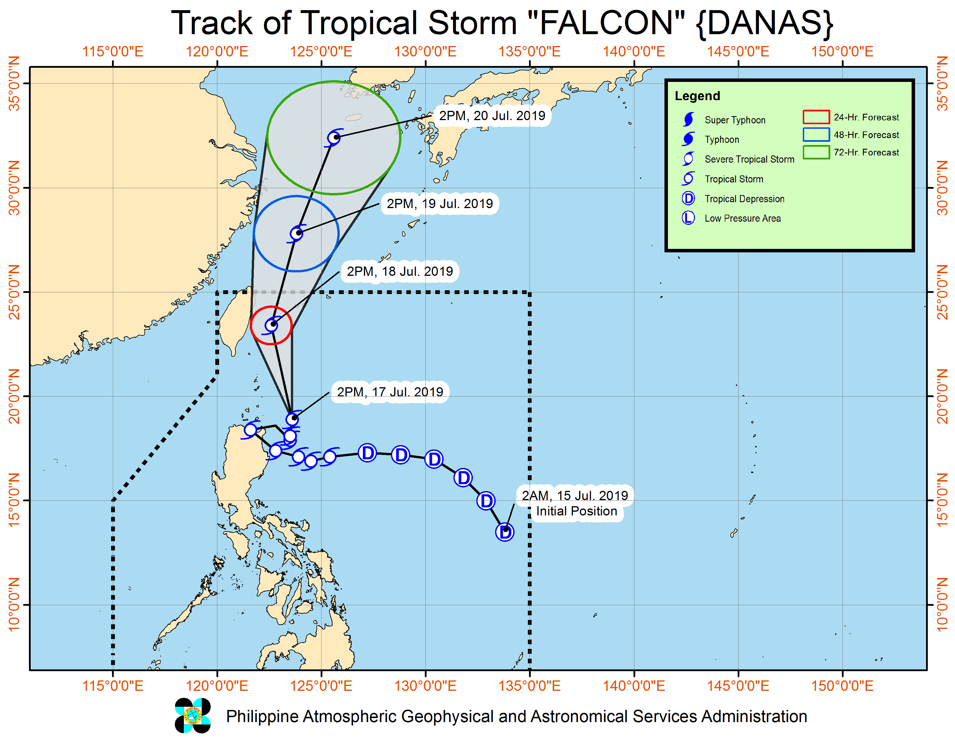
The Philippine Atmospheric, Geophysical and Astronomical Services Administration (Pagasa) said Falcon was estimated at 265 kilometers (km) east of Calayan, Cagayan, moving north northwest at a slower pace of 20 kph from 35 kph earlier on Wednesday as it hit land.
Pagasa said moderate to at times heavy rains would be experienced over Zambales, Bataan, Cavite, Batangas, Occidental Mindoro, northern Palawan including Calamian and Cuyo Islands, and Romblon.
Light to moderate with at times heavy rains will be experienced over Metro Manila and the rest of Luzon and the Visayas.
Falcon is expected to be out of the Philippine area of responsibility by Friday afternoon. (PressONE.ph)