(Position and Tracking of Tropical Depression Vicky/ Pagasa Website)
(Position and Tracking of Tropical Depression Vicky/ Pagasa Website)
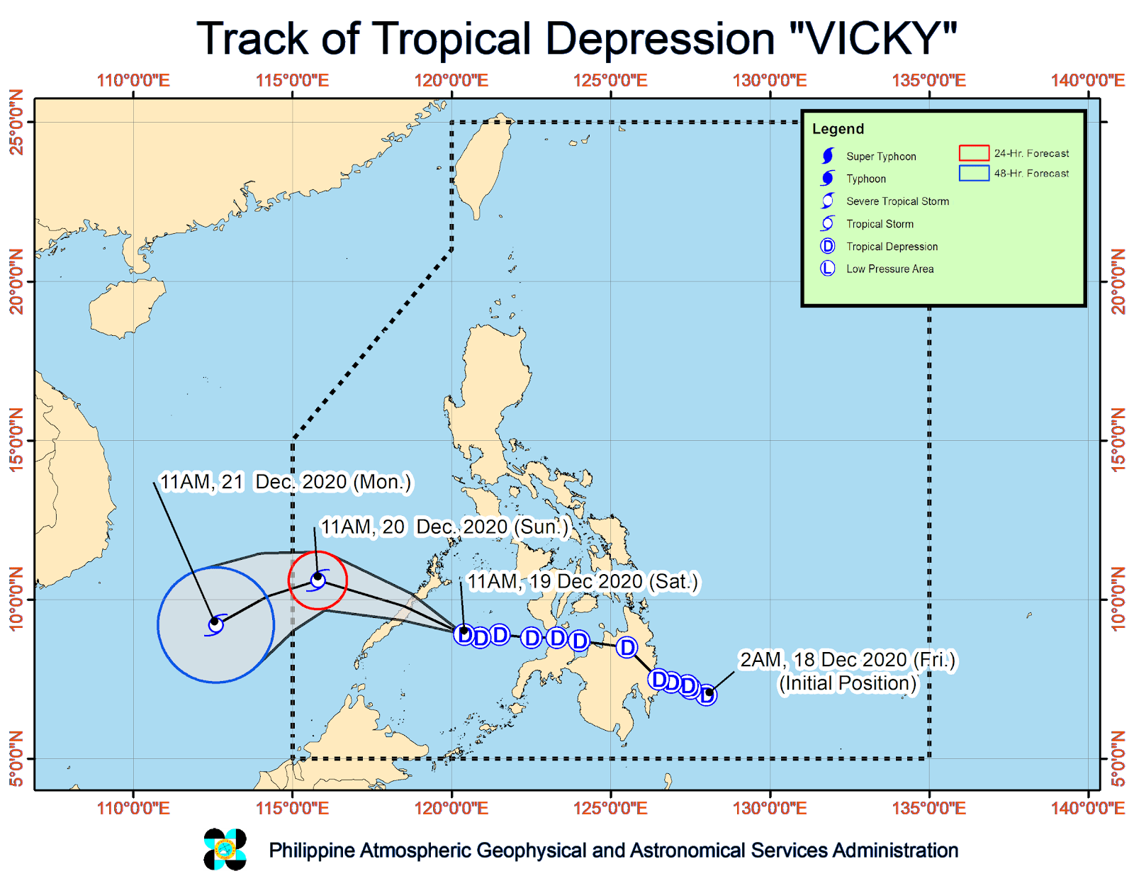
Tropical Depression “Vicky” is expected to make landfall in Palawan Saturday night, after battering Northern Mindanao with heavy rains, weather forecasters said.
“Vicky” was crossing Sulu Sea and making its way toward central Palawan, tracking by the Philippine Atmospheric, Geophysical and Astronomical Services Administration (Pagasa) showed.
It is expected to reach Puerto Princesa City by evening and by Sunday Morning will be east-southeast of Kalayaan Islands.
Pagasa hoisted Tropical Cyclone Wind Signal No. 1 over the northern and central portions of Palawan (Araceli, Dumaran, Taytay, El Nido, San Vicente, Roxas, Puerto Princesa City, Aborlan, Narra, Quezon, Sofronio Espanola) including Calamian, Cuyo, Cagayancillo, and Kalayaan Islands.
Pagasa said the tropical depression was likely to exit the Philippine Area of Responsibility tomorrow afternoon.
“Vicky is forecast to remain a tropical depression while crossing the Philippine archipelago. However, once it reaches the West Philippine Sea, ‘Vicky’ is forecast to intensify into a tropical storm,” the state weather agency said in its 5 p.m. advisory.
Vicky’s initial position was tracked east of Mindanao. It made its first landfall in Davao Oriental on Dec 18.
A no-sailing policy has been enforced in the areas of Agutaya, Cuyo, and Dumaran in Palawan as sea travel is risky especially for small sea vessels, due to heavy winds and rainfall, authorities said. Harvey Custodio with reports from Krizzia Nieva