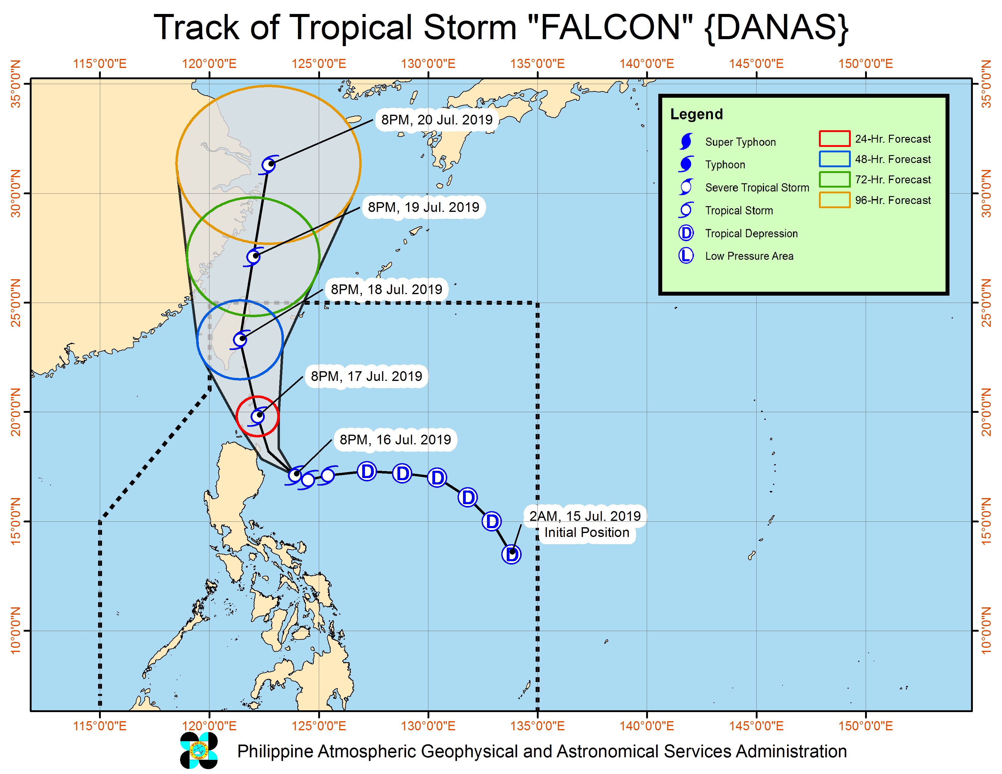
‘Falcon’ is expected to be at 75 km south-southeast of Basco, Batanes by Wednesday evening and 325 km north by Thursday evening.
Weather forecasters raised Tropical Cyclone Warning Signal No. 2 over Batanes and the northeastern portion of Cagayan, including the Babuyan Group of Islands, at 11 p.m. on Tuesday, as northern Luzon braced for tropical storm “Falcon.”
The Philippine Atmospheric, Geophysical and Astronomical Services Administration (Pagasa) also raised Signal No. 1 over the rest of Cagayan, Ilocos Norte, Abra, Apayao, Kalinga, Isabela, Mountain Province, Ifugao, the northern portion of Aurora, the northern portion of Nueva Vizcaya and the northern portion of Quirino.
Signal No. 2 means winds of greater than 61 kilometers per hour (kph) and up to 120 kph may be expected in at least 24 hours. Signal No. 1 means winds of 30-60 kph may be expected in at least 36 hours, or intermittent rains may be expected within 36 hours.
At 10:00 p.m. on Tuesday, the center of Falcon was estimated at 195 kilometers (km) east-southeast of Tuguegarao City, Cagayan, moving west at 25 kph.
Falcon had maximum sustained winds of 65 kph near the center and gustiness of up to 80 kph.
It was expected to be at 75 km south-southeast of Basco, Batanes by Wednesday evening and 325 km north by Thursday evening.
Pagasa said moderate to heavy rains would be experienced over Ilocos Region, Cordillera Administrative Region, Cagayan Valley, Nueva Ecija, Aurora, Zambales, Occidental Mindoro, northern Palawan including Calamian and Cuyo Islands, Aklan, Antique, Capiz, Iloilo and Guimaras until Wednesday evening.
Light to moderate with at times heavy rains will be experienced over Metro Manila, Calabarzon, the Bicol Region, and the rest of Visayas, Central Luzon, and Mimaropa.
The Philippine Coast Guard on Tuesday suspended passenger sea travel to destinations in the Bicol Region and the Visayas because of the storm. (PressONE.ph)