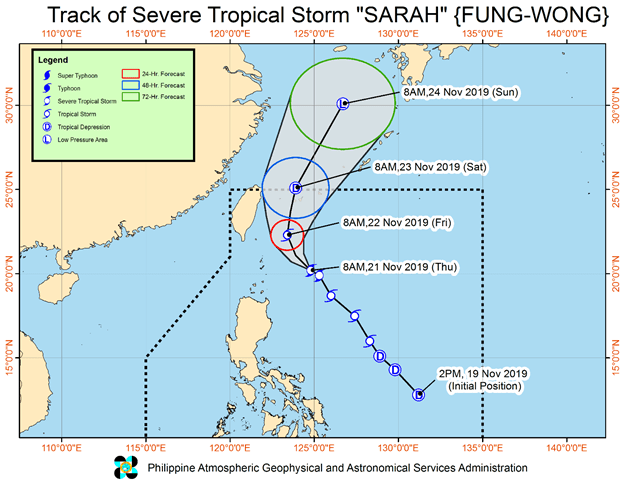
Forecast track of Tropical storm Sarah (Image from PAGASA)
The Philippine Atmospheric, Geophysical and Astronomical Services Administration (PAGASA) lifted tropical cyclone wind signal (TCWS) number 1 over Babuyan islands as severe tropical storm Sarah (Fung-wong) moves out of the country.
Now moving west, northwest at 10 kilometers per hour, the storm’s center was estimated to be at 275 km East of Basco, Batanes at 10 am this morning.
But despite the lower chance of landfall due to change in Sarah’s direction, rain showers ranging from light to moderate with some isolated heavy rainfall will still be felt over Isabela, the eastern side of Cagayan, Aurora and northern Quezon.
Sarah is expected to slowly weaken starting tomorrow Saturday as it makes its exit from the Philippine Area of Responsibility (PAR).
Given this weather condition, sea travel remains risky, especially for small sea crafts, over the seaboards of areas under signal number1, seaboards of Northern and Central Luzon, and the western seaboard of Southern Luzon. (Jojo Mangahis)