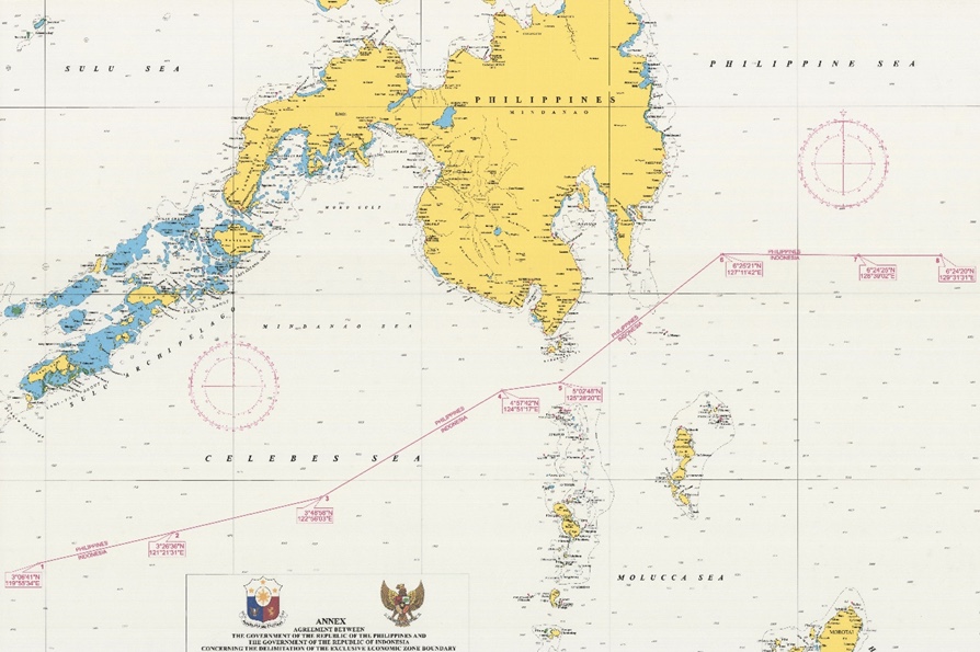
The Philippines-Indonesia EEZ boundary map from the National Mapping and Resource Information Authority.
Manila and Jakarta have formally fixed their maritime boundaries under an agreement that took years for the world’s two largest archipelagic states to negotiate.
The agreement delineates the boundary between overlapping exclusive economic zones (EEZs) of the Philippines and Indonesia, in accordance with the 1982 United Nations Convention on the Law of the Sea (Unclos).
The EEZs of the Philippines and Indonesia overlapped across the Mindanao Sea and Celebes Sea, and in the southern section of the Philippine Sea in the Pacific Ocean.
Foreign Affairs Secretary Teodoro Locsin Jr. and Indonesian Foreign Minister Retno Marsudi exchanged instruments of ratification in a special ceremony on Aug. 1 in Bangkok, at the sidelines of a meeting of Southeast Asian foreign ministers.
The two also signed protocols of exchange of the instruments of ratification.
The agreement was first discussed on June 23-25 1994, and formally signed by the two countries on May 23, 2014 in Manila.
It was ratified by President Rodrigo Duterte on Feb. 15 2017 and by the Indonesian Parliament on April 27, 2017.
The Philippine Senate concurred with the Duterte’s ratification on June 3, 2019.
In a statement, the Department of Foreign Affairs said the agreement was expected to benefit both countries, “economically and politically, by promoting more bilateral cooperation in the EEZ in order to advance the common interest of managing and preserving the resources in the EEZ and further strengthening maritime security cooperation between the two countries.”
Under the Unclos, archipelagic states like the Philippines and Indonesia are entitled to EEZs of 200 nautical miles, within which states have sovereign rights to explore and exploit, and conserve and manage natural resources. (PressONE.ph)