Batanes and Babuyan Islands are currently under Tropical Cyclone Wind Signal (TCWS) No. 2 as Severe Tropical Storm Siony, with an international code name “Atsani,” passes Misanga island in Itbayat, Batanes, on Friday morning, according to the Philippine Atmospheric Geophysical and Astronomical Services Administration (PAGASA).
Areas under TCWS No. 1 are as follows:
- northern portion of mainland Cagayan (Santa Ana, Gonzaga, Lal-Lo, Allacapan, Santa Teresita, Buguey, Camalaniugan, Aparri, Ballesteros, Abulug, Pamplona, Sanchez-Mira, Claveria, Santa Praxedes),
- the northern portion of Apayao (Santa Marcela, Luna, Calanasan), and
- the northern portion of Ilocos Norte (Adams, Pagudpud, Bangui, Dumalneg, Burgos, Vintar, Pasuquin, Bacarra)
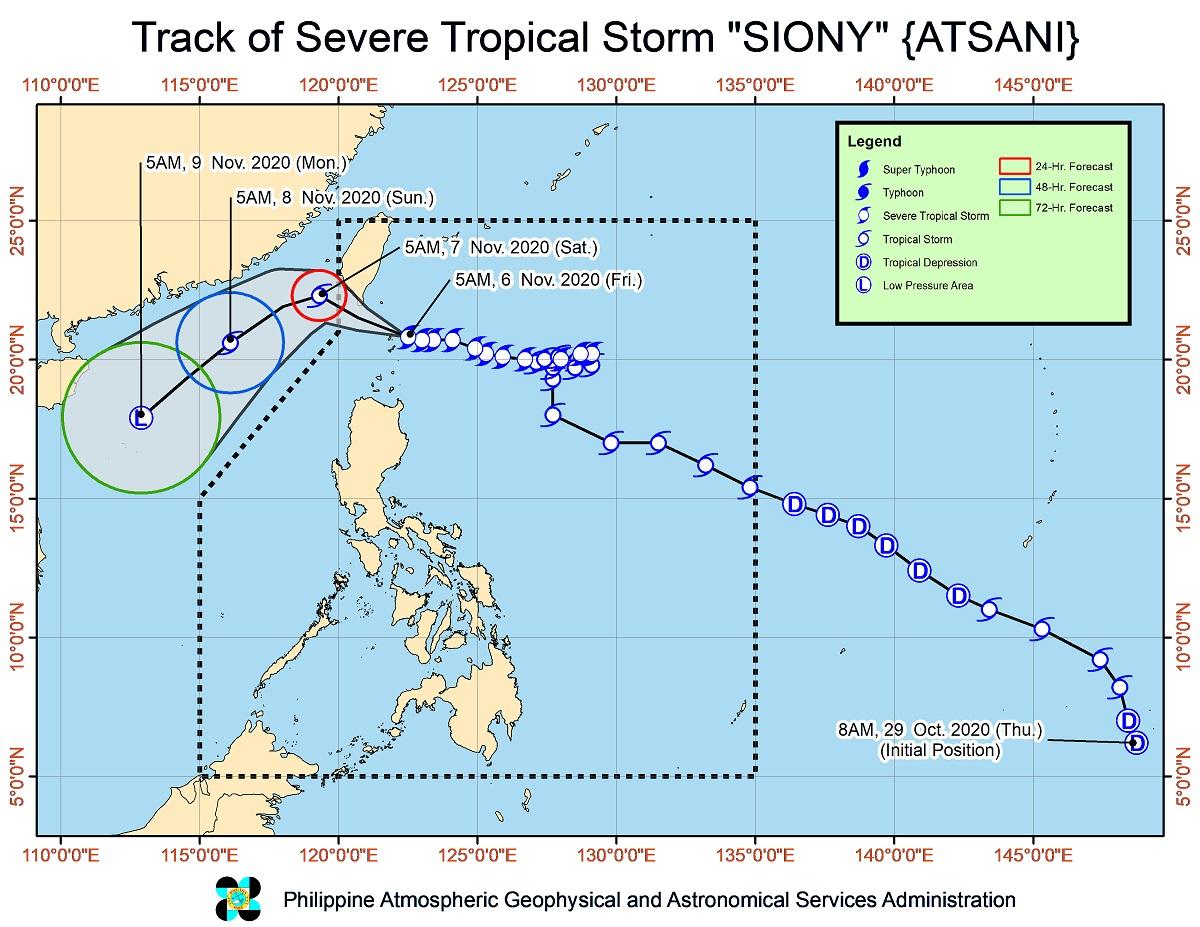
According to PAGASA’s 8 a.m. weather forecast, Typhoon Siony will continue moving westward to west-northwestward and pass over the sea off the southern coast of Taiwan within 12 hours.
Siony is expected to exit the Philippine Area of Responsibility by Friday evening. It is also forecasted that the typhoon to either maintain its current strength of 95 km/h or slightly intensify to 100 km/h within the next 24 hours.
“Afterwards, it will turn southwestward tomorrow morning over the sea to the southwest of Taiwan and move over the West Philippine Sea towards the Paracel Islands area,” PAGASA said.
The center of Siony was seen 30 km east northeast of Itbayat, Batanes as of 7 a.m. Friday. It is moving westward at 20 km/h with maximum sustained winds of 95 km/h near the center and gustiness of up to 115 km/h. RJ Espartinez