Forecast track of tropical storm ‘Falcon’ (pagasa.dost.gov.ph)
Updated as of 9:00 a.m., July 17, 2019
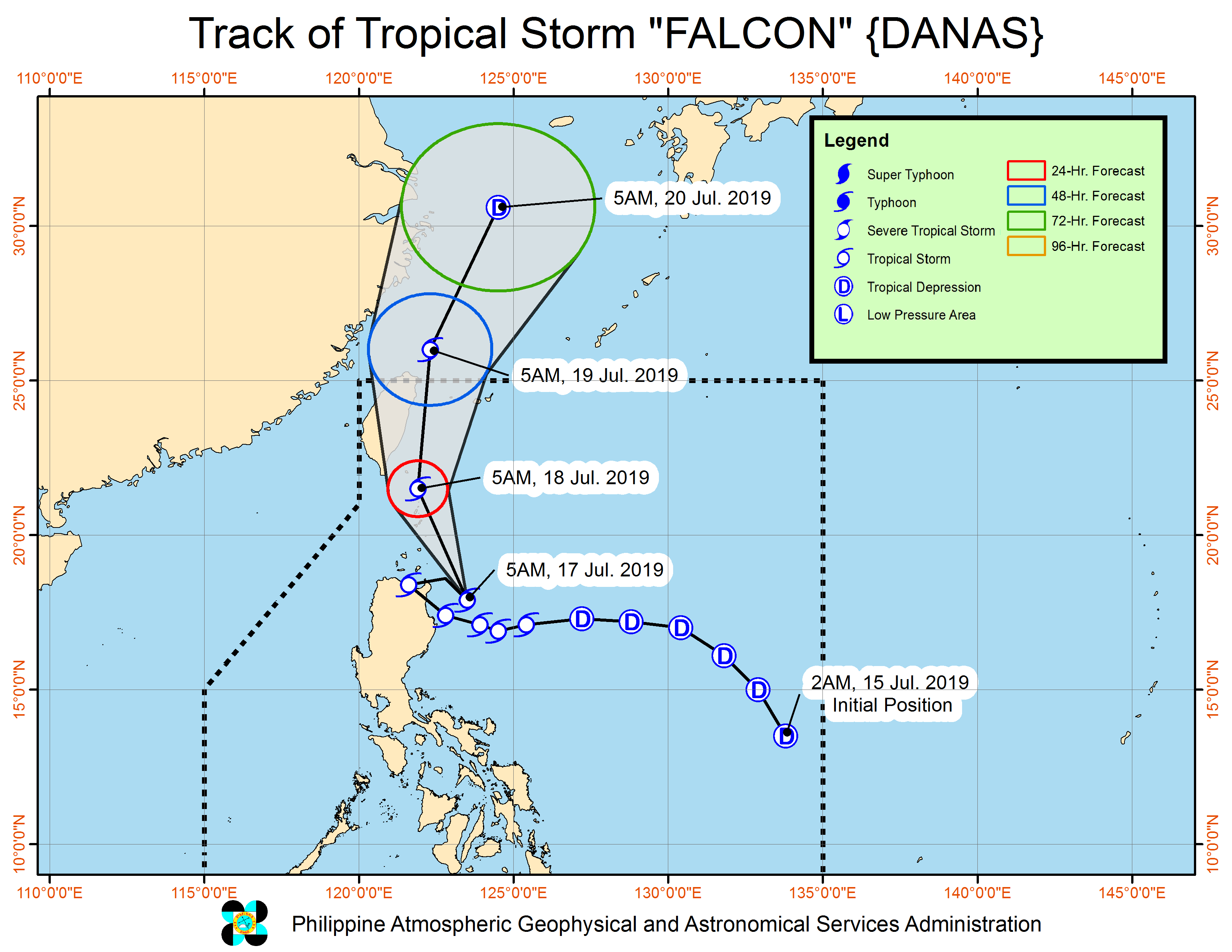
The weather bureau placed Apayao and Cagayan provinces under Signal No. 2 but lifted Signal No. 1 over the northern portions of Aurora, Nueva Vizcaya and Quirino, as tropical storm “Falcon” made its way through northern Luzon.
Falcon, whose track has looped, was spotted at 200 kilometers (km) east of Aparri, Cagayan at 7 a.m. on Wednesday, moving west northwest at 20 (kilometers per hour (kph).
It kept maximum sustained winds of 65 kph near the center and gustiness of up to 80 kph.
Also under Signal No. 2 were Batanes and the Babuyan Group of Islands. These areas will experience winds of greater than 61 kph and up to 120 kph in at least 24 hours.
Signal No. 1 was hoisted over six areas: Ilocos Norte, Abra, Kalinga, Isabela, Mountain Province and Ifugao.
Moderate to heavy rains were expected over Ilocos Region, Cordillera Administrative Region, Cagayan Valley, Central Luzon, Cavite, Batangas, Occidental Mindoro, northern Palawan including Calamian and Cuyo Islands, Aklan, Antique, Capiz, Iloilo, and Guimaras, the Philippine Atmospheric, Geophysical and Astronomical Services Administration (Pagasa) said.
Pagasa said light to moderate with at times heavy rains would be experienced over Metro Manila, Calabarzon, Bicol Region, and the rest of Visayas, and the rest of Mimaropa.
Falcon is expected to be out of the Philippine area of responsibility by Friday morning. (PressONE.ph)